REDLANDS, California: In a partnership set to redefine Africa’s digital map, geospatial technology leader Esri has announced a five-year alliance with UAE-based space and AI company Space42 and technology giant Microsoft to deliver the most comprehensive high-resolution basemaps ever compiled for the continent. The initiative, dubbed “Map Africa,” aims to bridge critical gaps in geographic data, powering economic growth and innovation for more than 1.4 billion people across Africa’s 54 countries.
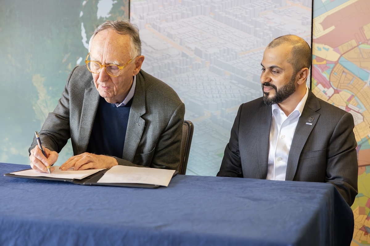
The collaboration was formalized at the Esri User Conference earlier this month in San Diego, California, where Esri President Jack Dangermond and Space42 CEO Hasan Al Hosani signed a Memorandum of Understanding (MoU) that cements the consortium’s commitment to advancing African geospatial capabilities. Microsoft, joining as a key technology partner, will provide the secure artificial intelligence and cloud infrastructure required for processing and distributing this vast trove of data.
Fixing Africa’s Mapping Deficit
For decades, many official African maps have remained fragmented, outdated, or difficult to access, hampering government decision-making, infrastructure investment, and disaster response. This data deficit has contributed to inefficiencies in development, economic planning, and resource management at both national and local levels.
Jack Dangermond, Esri’s president, emphasized the stakes: “Transforming satellite imagery into detailed, accurate basemaps at a continental scale requires advanced geospatial technology and sophisticated production workflows. The Map Africa Initiative will set a new benchmark, supporting infrastructure planning, sustainable development, and economic opportunity throughout the region.”
Space42, formed after the high-profile merger of Bayanat and Yahsat in 2024, will oversee fundraising and project management, leveraging its satellite fleet to supply much of the raw data. Esri will deploy innovative GeoAI and remote sensing capabilities to orchestrate basemap production, while also establishing regional hubs to help African teams develop expertise and ensure long-term self-reliance. Microsoft’s Azure cloud platform will underpin the operation, enabling large-scale processing, secure storage, and collaborative access for partners and local agencies.
Driving Economic and Social Transformation
The Map Africa Initiative goes far beyond technical cartography, seeking to unlock seismic benefits across multiple sectors:
- Ports and Logistics: Enhanced terrain and infrastructure data will enable smarter route planning and reduced operational inefficiencies across Africa’s bustling trade corridors.
- Renewable Energy: Precise site selection models will fuel more efficient deployment of solar and wind projects in support of Africa’s clean energy ambitions.
- Security and Disaster Response: Governments will gain robust new tools to monitor borders, manage resources, and coordinate timely emergency responses to natural and humanitarian crises.
- Smart Cities and Digital Economies: Accurate, up-to-date maps will underpin the next wave of urban planning, public service delivery, and tech-driven entrepreneurship.
“Accurate, high-quality mapping and the intelligence solutions built on it are essential for growth, resilience, and inclusive innovation,” said Hasan Al Hosani, CEO of Smart Solutions at Space42. “This collaboration not only strengthens our role as a trusted partner to governments, but also delivers meaningful benefits to communities all across Africa.”
A cornerstone of the initiative is to license the data to national governments, ensuring that African countries retain ownership and control over their geospatial assets. National Mapping Agencies will be equipped to manage and update this crucial information long after the initial project concludes, building an ongoing legacy of digital capacity.
The partners also envision a thriving commercial ecosystem, as newly accessible geospatial data catalyzes the rise of African startups and technology companies. Data will ultimately be housed in regional data centers managed by G42 and Microsoft, maximizing sovereign control and sustainability.
The Map Africa partnership represents a forward step toward closing Africa’s geospatial knowledge gap, with the promise of empowering governments, businesses, and communities with the information needed to shape a brighter and more prosperous future.