In a significant milestone for US-India space collaboration, NASA and the Indian Space Research Organisation (ISRO) are ready to launch the NASA-ISRO Synthetic Aperture Radar (NISAR) satellite, the world’s most advanced Earth-observing radar mission. The highly anticipated launch is scheduled for 8:10 a.m. EDT (5:40 p.m. IST) on Wednesday, July 30, from Satish Dhawan Space Centre in Sriharikota, India.
The Mission: Revolutionizing Global Earth Monitoring
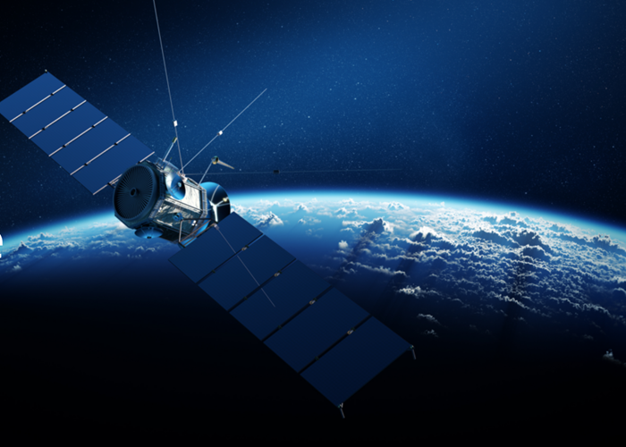
NISAR marks the first satellite mission jointly developed by NASA and ISRO, symbolizing a new era in international space cooperation and science leadership. The satellite will ride aboard an ISRO Geosynchronous Satellite Launch Vehicle (GSLV), orbiting at approximately 747 km in a sun-synchronous orbit that enables consistent monitoring of Earth’s surface.
Data from NISAR will map changes to Earth’s surface, helping improve crop management, natural hazard monitoring, and tracking of sea ice and glaciers.
Hailed as a critical part of a pioneering year for U.S.-India civil space cooperation by President Trump and Prime Minister Modi during their visit in Washington in February, the NISAR launch will advance U.S.-India cooperation and benefit the U.S. in the areas of disaster response and agriculture.
As the first joint satellite mission between NASA and the Indian Space Research Organisation (ISRO), NISAR marks a new chapter in the growing collaboration between the two space agencies. Years in the making, the launch of NISAR builds on a strong heritage of successful programs, including Chandrayaan-1 and the recent Axiom Mission 4, which saw ISRO and NASA astronauts living and working together aboard the International Space Station for the first time.
The information NISAR provides will help decision-makers, communities, and scientists monitor agricultural fields, refine understanding of natural hazards such as landslides and earthquakes, and help teams prepare for and respond to disasters like hurricanes, floods, and volcanic eruptions. The satellite will also provide key global observations of changes to ice sheets, glaciers, and permafrost, as well as forests and wetlands.
Here are five things to know about NISAR:
- The NISAR satellite will provide a 3D view of Earth’s land and ice.
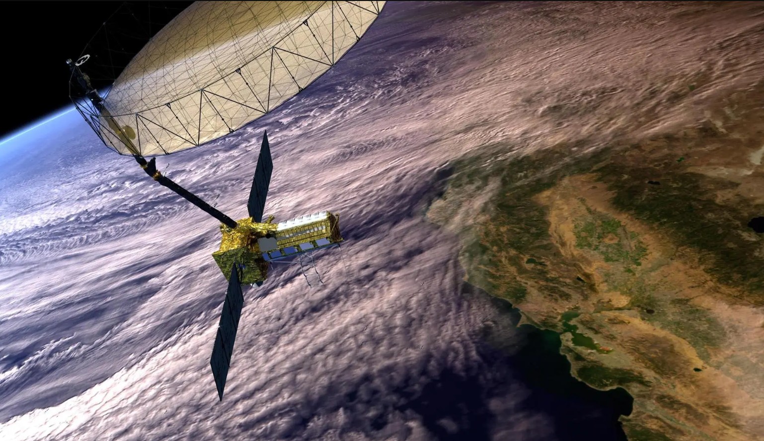
Two synthetic aperture radars (SARs) aboard NISAR will detect changes in the planet’s surface down to fractions of an inch. The spacecraft will bounce microwave signals off Earth’s surface and receive the return signals on a radar antenna reflector measuring 39 feet (12 meters) across. The satellite’s ability to “see” through clouds and light rain, day and night, will enable data users to continuously monitor earthquake- and landslide-prone areas and determine how quickly glaciers and ice sheets are changing. It also will offer unprecedented coverage of Antarctica, information that will help with studying how the continent’s ice sheet changes over time.
- Data from NISAR will provide critical insights to help governments and decision-makers plan for natural and human-caused hazards.
Earthquakes, volcanoes, and aging infrastructure can pose risks to lives and property. Able to see subtle changes in Earth’s surface, NISAR can help with hazard-monitoring efforts and potentially give decision-makers more time to prepare for a possible disaster. For earthquakes, NISAR will provide insights into which parts of a fault slowly move without producing quakes and which are locked together and could potentially slip. The satellite will be able to monitor the area around thousands of volcanoes, detecting land movement that could be a precursor to an eruption. When it comes to infrastructure such as levees, aqueducts, and dams, NISAR data collected over time can help managers detect if nearby land motion could jeopardize key structures, and then assess the integrity of those facilities.
- The most advanced radar system ever launched as part of a NASA or ISRO mission, NISAR will generate more data on a daily basis than any previous Earth satellite from either agency.
About the length of a pickup truck, NISAR’s main body contains a dual-radar payload — an L-band system with a 10-inch (25-centimeter) wavelength and an S-band system with a 4-inch (10-centimeter) wavelength. Each system is sensitive to land and ice features of different sizes and specializes in detecting certain attributes, such as moisture content, surface roughness, and motion. By including both radars on one spacecraft — a first — NISAR will be more capable than previous SAR missions. These two radars, one from NASA and one from ISRO, and the data they will produce, exemplify how collaboration between spacefaring allies can achieve more than either would alone.
The radars will generate about 80 terabytes of data products per day over the course of NISAR’s prime mission. That’s roughly enough data to fill about 150 512-gigabyte hard drives each day. The information will be processed, stored, and distributed via the cloud — and accessible to all.
- The NISAR mission will help monitor ecosystems around the world.
The mission’s two radars will monitor Earth’s land and ice-covered surfaces twice every 12 days. Their near-comprehensive coverage will include areas not previously covered by other Earth-observing radar satellites with such frequency. The NISAR satellite’s L-band radar penetrates deep into forest canopies, providing insights into forest structure, while the S-band radar is ideal for monitoring crops. The NISAR data will help researchers assess how forests, wetlands, agricultural areas, and permafrost change over time.
- The NISAR mission marks the first collaboration between NASA and ISRO on a project of this scale and marks the next step in a long line of Earth-observing SAR missions.
The NISAR satellite features components developed on opposite sides of the planet by engineers from ISRO and NASA’s Jet Propulsion Laboratory working together. The S-band radar was built at ISRO’s Space Applications Centre in Ahmedabad, while JPL built the L-band radar in Southern California. After engineers from JPL and ISRO integrated NISAR’s instruments with a modified ISRO I3K spacecraft bus and tested the satellite, ISRO transported NISAR to Satish Dhawan Space Centre in May 2025 to prepare it for launch.
The SAR technique was invented in the U.S. in 1952 and now countries around the globe have SAR satellites for a variety of missions. NASA first used the technique with a space-based satellite in 1978 on the ocean-observing Seasat, which included the first spaceborne SAR instrument for scientific observations. In 2012, ISRO began launching SAR missions starting with Radar Imaging Satellite (RISAT-1), followed by RISAT-1A in 2022, to support a wide range of applications in India.
Managed by Caltech in Pasadena, JPL leads the U.S. component of the project and provided the L-band SAR. JPL also provided the radar reflector antenna, the deployable boom, a high-rate communication subsystem for science data, GPS receivers, a solid-state recorder, and payload data subsystem. NASA’s Goddard Space Flight Center manages the Near Space Network, which will receive NISAR’s L-band data.
The ISRO Space Applications Centre is providing the mission’s S-band SAR. The U R Rao Satellite Centre is providing the spacecraft bus. The rocket is from Vikram Sarabhai Space Centre, launch services are through Satish Dhawan Space Centre, and satellite mission operations are by the ISRO Telemetry Tracking and Command Network. The National Remote Sensing Centre is responsible for S-band data reception, operation.
Key Features of NISAR
| Feature | Details |
| Dual Radar Frequencies | L-band (NASA) and S-band (ISRO) synthetic aperture radars |
| Imaging Capability | High-resolution, all-weather, day-and-night imaging |
| Monitoring | Land, ice sheets, glaciers, forests, agricultural areas, infrastructure |
| Data Availability | Free access to data, with rapid release during natural disasters |
| Swath Width | 242km – covers entire globe every 12 days |
| Total Mission Cost | Over $1.5 billion, making it the most expensive Earth-imaging satellite to date |
Scientific and Societal Impact
With NISAR, scientists and policymakers will gain access to unmatched, high-resolution data capturing changes on Earth with centimeter-level precision. By providing global coverage every 12 days, the mission will:
- Detect Land Surface Changes: Track deformation, landslides, earthquakes, and surface shifts, enabling disaster preparedness and response.
- Monitor Ice Sheets and Glaciers: Measure ice mass loss and glacier movement, empowering climate science and sea-level monitoring.
- Support Agriculture: Deliver vital data on crop patterns, soil moisture, and sustainable farming practices.
- Protect Infrastructure: Aid in the management of cities, disaster zones, and critical structures through real-time deformation mapping.
Both President Trump and Prime Minister Modi have emphasized NISAR’s role as a flagship initiative in a year marked by significant U.S.-India civil space cooperation. The mission stands to benefit not only these two nations but also scientists, emergency responders, and communities around the world.
Behind the Technology: Collaborative Innovation
NISAR’s unique design features two radar systems: ISRO’s S-band and NASA’s L-band. Working together, they provide scientists with complementary information—S-band penetrates forests and ice, while L-band excels in mapping topography and surfaces obscured by vegetation. The satellite’s enormous 12-meter mesh antenna deploys in space to maximize coverage and resolution, making it the largest radar reflector ever sent into orbit by NASA.
ISRO contributed the satellite bus, S-band radar, launch vehicle, and integration services, while NASA provided the L-band radar, communications, GPS, and the reflector antenna. This collaboration highlights the synergy between American and Indian engineering excellence.
NASA plans rapid public distribution of NISAR’s data — within hours of collection for emergencies and natural disasters, and within 1–2 days for routine observations. Scientists, decision-makers, and the public can access insights via dedicated platforms and mission resources.
This historic launch builds upon a legacy of joint achievements, including Chandrayaan-1, shared International Space Station missions, and years of research synergy between the world’s leading space agencies.
By pioneering advanced radar technology and delivering actionable insights, NISAR is set to transform global understanding of Earth’s dynamic surface—heralding a new chapter in international space science