In a leap for international space science, NASA and the Indian Space Research Organisation (ISRO) celebrated the successful launch of their most powerful Earth observation satellite, NISAR (NASA-ISRO Synthetic Aperture Radar), on July 30, 2025. The mission unites two spacefaring giants on a singular purpose: to track the planet’s frail equilibrium and arm communities with real-time, pinpoint data for tackling both natural and human-made hazards—from earthquake faults to receding glaciers and crumbling levees.
The New Standard in Global Radar Imaging
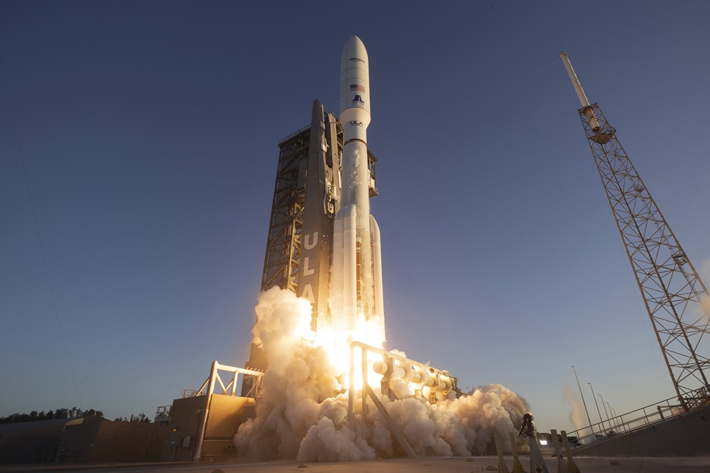
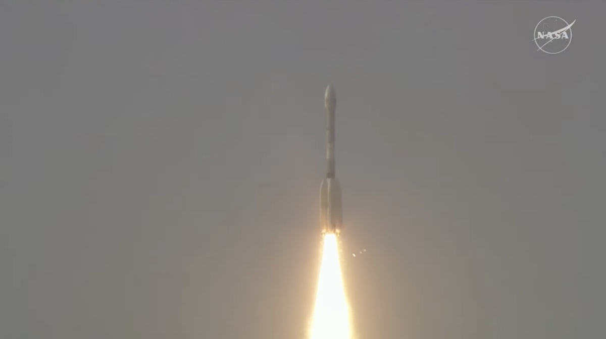
NISAR rocketed into a sun-synchronous orbit, 747km above Earth, after lifting off at 5:10 p.m. IST from India’s Satish Dhawan Space Centre, Sriharikota, aboard the GSLV-F16 rocket. Minutes later, ISRO ground controllers confirmed full communication with the satellite, marking a seamless beginning for a collaboration a decade in the making.
For at least the next three years, NISAR will scan nearly the entire planet every 12 days, using its two cutting-edge radars—NASA’s L-band and ISRO’s S-band—to capture dynamic, three-dimensional snapshots of Earth’s land and ice surfaces with unprecedented precision. The radar systems can detect movement down to centimeters, enabling a previously impossible level of insight into the ways our world is shifting—whether it’s crops growing, forests shrinking, tectonic plates slipping, or cities subsiding.
A Satellite Built for Urgency
The scale and urgency of Earth’s environmental crises are what shaped NISAR’s mission profile. Volcanic eruptions, earthquakes, landslides, hurricanes, floods—such disasters often strike suddenly, but their warning signals can now be quantified before catastrophe. NISAR’s ability to penetrate clouds and operate night and day means no region, or emergency, is out of reach when it comes to delivering timely, actionable data.
Unlike most existing satellites, NISAR makes all its high-resolution data freely available worldwide within 24–48 hours, with near-real-time delivery in emergencies. This “open data” policy democratizes scientific knowledge, letting researchers and decision-makers—from Los Angeles to Lucknow—protect lives, infrastructure, and livelihoods with critical lead time.
Dual-Band Breakthrough, Unprecedented Collaboration
What sets NISAR apart is the marriage of the L-band and S-band radar technologies on a single platform—a world first. NASA’s L-band radar excels at deeper penetration, mapping soil moisture, ground movement, and forest biomass, while ISRO’s S-band radar is peerless in tracking finer features of agricultural land, wetlands, and infrastructure.
For the first time, the strengths of both radars can be combined to deliver layered, complementary views of the same location, tracking changes large and small. This approach benefits researchers monitoring everything from glacial retreat in the Himalayas to levee instability in hurricane-prone regions, to changes in permafrost and even the carbon locked in Earth’s increasingly fragile ecosystems.
Indian expertise extended across the spacecraft’s development, with Ahmedabad’s Space Applications Centre pioneering the S-band radar and data systems, and Bangalore’s U R Rao Satellite Centre building the spacecraft’s robust bus and integrating NASA’s L-band instrumentation.
Local Impact, Global Science
From space, NISAR addresses concerns close to home and vital to humanity’s future. For India, it means better tools for precision agriculture, water management, infrastructure safety, and disaster risk reduction—all aligning with national priorities and boosting India’s standing as a leader in space-based Earth science. For the US, the technology offers transformative improvements in monitoring seismic risk, wildfire recovery, and understanding the broader climate system.
Globally, the NISAR mission throws open the doors for poorer nations to access the same state-of-the-art data, supporting climate research, early warning systems, and international response efforts in real time. The satellite’s antenna, a 12-meter gold-mesh reflector, will soon unfurl and begin sampling the surface across hemispheres, including the remote and cloud-blanketed regions that optical satellites cannot penetrate.
A New Era for Civil Space Partnerships
NISAR reflects more than technological prowess; it’s a symbol of deepening US-India strategic ties and shared commitment to science for global good. “Where moments are most critical, NISAR’s data will help ensure the health and safety of those impacted on Earth, as well as the infrastructure that supports them, for the benefit of all,” said Nicky Fox, NASA’s Science Mission Directorate associate administrator.
ISRO Chairman V Narayanan echoed the magnitude of the mission: “With this successful launch, we are at the threshold of fulfilling the immense scientific potential NASA and ISRO envisioned for the NISAR mission more than 10 years ago…the powerful capability of this radar mission will help us study Earth’s dynamic land and ice surfaces in greater detail than ever before”.
Mission Roadmap Ahead
In the upcoming weeks, NISAR will undergo a commissioning phase, deploying its massive antenna and calibrating instruments before full science operations begin. Once operational, the satellite will supply an unbroken stream of data that will change how scientists, governments, and citizens understand our world’s rapid transformation.
In the words of NASA JPL Director Dave Gallagher: “The mission’s measurements will be global but its applications deeply local, as people everywhere will use its data to plan for a resilient future.” The NISAR project, with its record-setting $1.5 billion budget, is not just groundbreaking technology—it’s an investment in a safer, more informed planet.
Thanks to NISAR, humanity just got a new set of eyes—watchful, unblinking, and built by hands on both sides of the globe—to witness, understand, and hopefully protect the only world we call home.